YOUR NEXT TRAVEL EXPERIENCE
Search Results
274 results found with an empty search
- DRIVING BACKROADS & HAUNTED BLACKWOOD
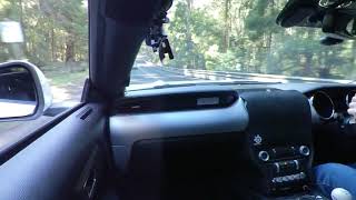
Blackwood The small town of Blackwood in Victoria is surrounded by the Wombat State Forest. A drive of about one hour northwest of the Melbourne CBD. There is a population of just a few hundred and the small community experiences cold and wet winters. Even locals are often heard to complain about the cold winter weather. There is a small mineral springs area behind the town centre accessed down a short unpaved road. Enabling those who choose to, to taste free natural mineral water trickling out from the earth. The town has a few small retail and coffee shops, a small post office and a hotel. Most are only open on selected weekdays or the weekend. Spirits At The Pub A captivating event that combines paranormal investigation with a delicious dinner experience. This unique gathering takes place once a month at the renowned Blackwood Hotel, a historic venue known for its mysterious past and eerie ambiance. Participants have the opportunity to explore the hidden corners of the hotel, seeking out signs of supernatural activity and communicating with spirits from another realm. During the investigation, guests are equipped with detecting apparel and guided through various areas of the hotel, including secluded corners where paranormal phenomena are said to occur. Experienced investigators share their knowledge and techniques, providing insights into the world of ghost hunting and the tools used to detect otherworldly presences. After the thrilling investigation, attendees can unwind and share their experiences. The cozy atmosphere of the pub adds to the mystique of the evening, creating a perfect setting for recounting chilling encounters and discussing the mysteries of the spirit world. Whether you're a sceptic or a believer, this experience is sure to leave you intrigued and perhaps even questioning the reality of the unseen forces that linger within the walls of the Blackwood Hotel. Bacchus Marsh Is a city located just off of the Western Freeway in Victoria. About fifty kilometres west of Melbourne. Population greater than twenty thousand. Traveldriven ENTER CLICK/TAP BLACKWOOD GOOGLE MAPS BACCHUS MARSH GOOGLE MAPS DRIVE BALLAN-BLACKWOOD-TRENTHAM-GISBORNE-BACCHUS MARSH FOREST DRIVE Driving a two hour loop through the forest. Ballan. Blackwood. Trentham. Gisborne. Bacchus Marsh. DRIVING BLACKWOOD TO TRENTHAM BLACKWOOD HOTEL 'RESURRECTION' est. 1868 Spirits At The Pub. Paranormal Investigation & Dinner Held once monthly. Inside the Blackwood Hotel STEAK SANDWICH, BLACKWOOD HOTEL MAIN BAR BLACKWOOD HOTEL, 'RESURRECTION' DRIVING BACCHUS MARSH PREV VICTORIA NEXT HOMEPAGE
- HIKE THE GRAND CANYON & PINNACLE IN THE GRAMPIANS
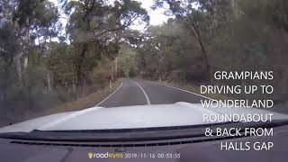
MOUNTAIN STREAM DRIVING Mt VICTORY ROAD TO WONDERLAND ROUNDABOUT The elevated drive from Halls Gap has very scenic views of the flora and landscape of the Grampians National Park. Within a few minutes drive from Halls Gap unobstructed views of the Elephants Hide become apparent across to the left of the road. The mountainous Elephants Hide is mostly bare grey rock with the occasional small bush and forms part of the mountainous Wonderland Range. If climbed upon, very slippery when wet. The drive is not recommended for caravans. However, it is a good sealed two-way road and may become busy on weekends and holiday periods. Grand Canyon/Pinnacle car parking is off of Mt Victory Road. A short drive from the Wonderland roundabout. Pinnacle Walking Track The following walks begin from the Grand Canyon and Pinnacle car parking apron in the Wonderland area which is a short drive off of Mt Victory Road. The Grand Canyon walking track is an alternate route to the Pinnacle Lookout and re-joins the Pinnacle track further on. At the end of the Grand Canyon and between two rock cliffs there is a short sturdy ladder with flat rungs and hand railing attached to the rock face that is used to climb up and over to re-join the Pinnacle walking track. Mountain Driving Mt Victory Road offers a picturesque drive that allows visitors to traverse the national park while enjoying stunning lookout points along the way. This scenic route provides a safe and well-maintained two-way road for travellers heading towards Horsham. The road's smooth surface ensures a comfortable journey, making it ideal for those looking to explore the natural beauty of the area by car. While Mt Victory Road is perfect for leisurely drives and sightseeing adventures, it is important to note that towing caravans is not advisable due to certain road conditions that may pose challenges for larger vehicles. Travellers are encouraged to plan their trips, accordingly, taking into consideration the road's suitability for their specific mode of transportation to ensure a smooth and enjoyable travel experience through this stunning region. Traveldriven ENTER CLICK/TAP GRAMPIANS NATIONAL PARK GOOGLE MAPS DRIVE MOUNT VICTORY ROAD HALLS GAP Mt VICTORY ROAD TO WONDERLAND GRAND CANYON IN THE GRAMPIANS PREV GRAMPIANS NEXT PREV VICTORIA NEXT HOMEPAGE
- HORSHAM IN THE WIMMERA WHEAT BELT
Horsham This is a regional city in the Wimmera region of western Victoria. Located on the Wimmera River the city is a retail centre for the Wimmera plains wheat belt. Horsham is about three hundred kilometres (190 mi) northwest of Melbourne. Horsham has an estimated population greater than sixteen thousand people. Held over the March Labour Day long weekend is the Horsham Fishing Competition on the banks of the Wimmera River which flows through the city. There are picnic facilities and free BBQs alongside the Wimmera River and a riverside caravan park. Horsham is a convenient overnight rest spot between Adelaide and Melbourne on the inland highway network connecting the two capital cities. Horsham in the Wimmera The city is a hub for the large surrounding Wimmera plains farming area. Two of the main crops grown are wheat and canola. Sheep farming is common. The city can be frosty in winter and hot in summer. The Western Highway passes through town and is the main connecting road to Adelaide and Melbourne. There are a number of lakes within a half hour driving distance of Horsham. Many are used for boating and fishing. Green Lake on the Melbourne side of the Western Highway is a scenic rest break under ten minutes' drive from Horsham. The Grampians National Park via Northern Grampians Road is about thirty minutes' drive away via the Zumsteins nature area. The all sealed Mt Victory Road (not caravan suitable) climbs over the range from Zumsteins to the small tourist township of Halls Gap on the other side. Traveldriven ENTER CLICK/TAP HORSHAM GOOGLE MAPS DRIVE HORSHAM GOOGLE MAPS GREEN LAKE 12 KM FROM HORSHAM ON THE WESTERN H\W GRAMPIAN'S IN THE BACKGROUND STOPPED FOR A COFFEE AT BRAD'S PLACE ALONG STAWELL ROAD HORSHAM AND RECEIVED FREE SAUSAGE ROLLS DRIVING HORSHAM ON THE BANKS OF THE WIMMERA RIVER HORSHAM & THE WIMMERA RIVER BRIDGE PREV VICTORIA NEXT HOMEPAGE
- THE SISTERS ROCKS, GRAFFITI GONE MAD
The Sisters Rocks Fred Flintstone would love this place. The rocks are an assortment of huge boulders found in bushland alongside the Western Highway, between Great Western and Stawell in Victoria. The granite boulders take their name from three sisters named Levi. They made temporary camp at the rocks which became known as the home of the three young sisters. Pioneering settlers of the gold rush era. As said, Fred Flintstone would feel right at home in this extraordinary location, where the landscape is dotted with an impressive array of massive rocks that resemble the iconic boulders of his animated world. These unique geological formations, known as the Sisters Rocks, are nestled within the picturesque bushland that lines the Western Highway, creating a striking contrast against the backdrop of the Australian countryside. The name of these granite boulders pays homage to the three sisters, Levi, who once sought refuge in this very spot, turning it into a temporary shelter that eventually became synonymous with their presence. Sisters Rocks Past & Present As the Sisters Rocks stand as silent witnesses to the passage of time, they also hold a significant historical connection to the pioneering settlers of the gold rush era in Victoria. These resilient individuals, driven by the promise of prosperity and adventure, traversed the rugged terrain in search of fortune, leaving behind a legacy that is etched in the very fabric of the land. Despite the valuable granite resource that these rocks offered, they remained untouched during the early days of settlement, residing on private land that shielded them from the tools of local stonemasons. Today, the Sisters Rocks serve as a reminder of a bygone era, a testament to the enduring spirit of exploration and resilience that defined the early settlers of this region. Visitors can marvel at the sheer size and beauty of these natural wonders, reflecting on the stories of the past that are etched into their ancient surfaces. Just like Fred Flintstone, anyone who sets foot in this place is sure to be captivated by the timeless allure of the Sisters Rocks. Rock Graffiti of the Sisters Rocks It's unknown when the painting of the rocks became widespread. A few small undefined indentations could go back to the earliest times of settlement in the district. No known indigenous rock art is onsite. The large and small granite rocks are covered in graffiti painted by roadside travellers. Travelling between Melbourne and Adelaide. Painted over many decades. Some graffiti must be painted with the use of ladders as much is very high on the rock face. The graffiti artwork has never been endorsed by authorities. The area may in future be closed to the general public. Short unsealed road entry. No toilets or waste bins onsite. Traveldriven DRIVE MELBOUNE TO SISTER ROCKS CARPARK VIEW SISTERS ROCKS GRAFFITI GRAFFITI ART MUSHROOMS? FACE PAINTING ROCK OVERHANG AND TREE TRUNKS ARE PAINTED EVEN SMALL ROCKS ARE PAINTED PREV VICTORIA NEXT HOMEPAGE
- DON'T GET STUCK IN SPIDER WEBS, LAKE ARGYLE ISLANDS OF WESTERN AUSTRALIA
small birds occasionally get trapped in the webs -Tour guide Lake Argyle of Western Australia Is Western Australia's largest freshwater man-made reservoir. Lake Argyle is part of the Ord River Irrigation Scheme and is seventy km by road from the East Kimberley town of Kununurra. One sealed road in and over the one and only bridge. The bridge is of a modern sturdy construction. On occasion in the wet season the bridge has raised concern of extreme monsoonal weather having the capacity of washing the bridge away. Spiders of Lake Argyle Golden Orb Spiders, a familiar sight on the islands dotting Lake Argyle, are known for their intricate webs that span across the gaps between bare branches of the island's small trees. These massive webs, often densely layered, can sometimes ensnare unsuspecting small birds that find themselves entangled in the sticky threads. Navigating through these intricate and tangled webs can be quite challenging, as they are predominantly crafted by the skilled Orb Spiders that call these islands home. One interesting fact about Orb Spiders is that their bites, while generally not dangerous to humans, can cause mild local pain, numbness, and swelling. Despite their potentially discomforting bite, these spiders play a crucial role in the ecosystem of Lake Argyle, helping to control insect populations and maintain the delicate balance of the island's biodiversity. The presence of these spiders adds a fascinating layer to the natural tapestry of the islands, showcasing the intricate interplay between different species in this unique environment. Freshwater crocodiles Numbers are estimated at over 25,000 in the lake. No saltwater crocodiles are said to be found. They much prefer mangrove habitat. However, a one hundred per cent guarantee is not assured. The lake has twenty-six species of native fish. Fish species known in Lake Argyle include; Barramundi Southern Saratoga Archer Fish Forktail Cat Fish Mouth Almighty (is an actual fish) Long Tom Bony Bream Sleepy Cod These fish species known to inhabit Lake Argyle are a fascinating mix of freshwater creatures that have adapted to the unique ecosystem of this reservoir. The Barramundi, a prized sportfish, is a common sight in these waters, known for its impressive size and fighting spirit. The Southern Saratoga, with its vibrant colors and distinctive fins, adds a splash of beauty to the lake. Archer Fish, famous for their ability to shoot down insects with water jets, showcase an interesting hunting behaviour. Among the lesser-known species, the Forktail Catfish lurks in the depths, its whiskers sensing the environment for food. The Mouth Almighty, an actual fish with a quirky name, captures attention with its peculiar features and behaviour. Long Toms, with their elongated bodies and sharp teeth, are efficient predators in these waters. Bony Bream, a staple food source for many other fish, play a crucial role in the lake's food chain. Lastly, the Sleepy Cod, a nocturnal species, brings a sense of mystery to Lake Argyle with its secretive habits and elusive nature. These diverse fish species collectively contribute to the rich biodiversity of Lake Argyle, making it a prime destination for anglers, researchers, and nature enthusiasts alike. Traveldriven ENTER CLICK/TAP LAKE ARGYLE GOOGLE MAPS IN REALTIME DRIVE KUNUNURRA TO LAKE ARGYLE A Lake Argyle island stop & giant spider webs (Island stop is no longer included in boat tour) VERY COLD POOL AND LAKE ARGYLE The one bridge crossing on the sealed road to Lake Argyle One of the very few boats Lake Argyle LAKE ARGYLE BOAT CRUISE & BBQ PREV SA/WA/NT NEXT PREV WEST AUSTRALIA NEXT HOMEPAGE
- MOUNT WELLINGTON LOOKOUT & NO VIEWS
Mount Wellington Lookout Hobart The summit is 1,271 metres (4,170 ft) above sea level and it frequently experiences snow. Falling snow may occur any month of the year. On the lower mountain sections there are walking tracks and some fire trails. The lookout is about 22 kilometres (14 mi) from Hobart CBD. An enclosed summit building offers views through large glass windows and panoramic views are often obstructed by cloud or fog. An outside elevated walkway gives a clearer view of Hobart city below. A distinctive feature of Mount Wellington is the cliff known as the Organ Pipes. The final few kilometres drive to the top is steep and narrow on a sealed road. Views are often obstructed by cloud most of the time. Winds can on occasion be over 160 km at the summit. During winter it frequently snows in the subzero temperatures and the mountain often receives a dusting of snow. Roadside gates may be closed occasionally in winter to stop access if deemed too dangerous to traffic. Mount Wellington is one of Traveldriven's top eight Australian lookouts. If the view is not obscured by cloud. For another top eight pick please go to: Albany Lookouts of Western Australia Post Traveldriven GOOGLE MAPS ENTER CLICK/TAP HOBART https://www.google.com/maps/place/Hobart ENTER CLICK/TAP MOUNT WELLINGTON https://www.google.com/maps/place /Mount+Wellington DRIVE HOBART TO MOUNT WELLINGTON MOUNT WELLINGTON MOUNT WELLINGTON ENCLOSED LOOKOUT VIEW TO HOBART BELOW THE CLOUDS CLOUDY NO VIEW, MOUNT WELLINGTON PREV PAGE NEXT HOMEPAGE
- ALBANY LOOKOUT, WESTERN AUSTRALIA
Albany Lookouts Drive Six hundred and fifty km. From Perth to Albany Lookout via Margaret River. Through the scenic south-west and it's small towns. The countryside appears similar to Western Victoria. With somewhat the same weather. Countryside has a green covering in the cooler months. A contrast to the hot North. Towns are closer together unlike in the North. Does Albany have the best Historic lookout in Australia? Albany has two different lookouts on the same access road with views over King George Sound. There are several small islands seaward. The town seems split in half by a few hills. Cold ocean swells are always rolling in. King George Sound and the Western Australian coast was the last sight of Australia and of home shores for forty thousand ANZAC troops final departure from Australia to the far-off shores of World War One battlefields. The Albany Lookouts are one of Traveldriven's top eight Australian lookouts. For another one of the top eight please go to: Boroka Lookout Victoria Post Traveldriven ENTER CLICK/TAP ALBANY GOOGLE MAPS DRIVE PERTH - MARGARET RIVER - ALBANY National Anzac Centre Walk ON GUARD Desert Mounted Corps Memorial, Albany ALBANY GOOGLE MAPS PREV WESTERN AUSTRALIA NEXT HOMEPAGE
- LAKE ARGYLE SONGS & PYTHONS BOAT TOUR THE ORD RIVER WESTERN AUSTRALIA
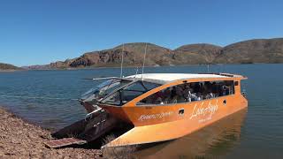
DAY 27, 28, 29, 30 Lake Argyle Freshwater Lake of Western Australia The reservoir is part of the Ord River Irrigation Scheme and is located near the East Kimberley town of Kununurra. Kununurra is the largest town in Western Australia north of Broome. Kununurra is 3,040 kilometres (1,889 mi) from Perth via the Great Northern Highway. Kununurra has extensive irrigation for cropping of over 20,000 hectares in the tropical heat. Water supply is from Lake Argyle. Lake Argyle is mainland Australia’s largest body of freshwater. 70 km southeast of Kununurra. The Lake Argyle Caravan Park (Resort) is a great base to unwind. Very large park. Free use of an infinity pool. Pool water is very cold. The surrounding view of the lake and cliffs are one of the best scenic views in Australia. During Lake Argyle peak periods, there is free nightly live entertainment provided by park management. Seasonal resident entertainers such as Steve Case. Python Speed Bump The Lake Argyle area is in tropical Western Australia. In the tropical top northwest of the State. Be careful nighttime solo driving from Kununurra to Lake Argyle Resort along the Lake Argyle Road. On return to the resort from Kununurra, past the bridge and on the only road in and out, and still 25 km to the campsite, I noticed a small speed hump across the sealed road. Upon driving closer only then I realised it was a python tail stretching two thirds across the road from the bush. The standard sealed road width in Australia is 3.5 metres. With this in mind, I would think around 4 metres in length or 13 feet. I drove around on the right-side road shoulder. No problem and kept driving. No other traffic at all. But it did make me think about securing my tent site. Lake Tours and BBQ Lake tours are available. Tours used to include a BBQ lunch stop on a small rocky island. As of 2025, no islands are accessed. Onboard the tour boat the lake appears more like an inland sea. Distant shorelines. Impossible to identify the route to the boat's jetty. Apparently, the lake barramundi are not the tastiest fish. Lake Argyle is home to thousands of freshwater crocodiles. Lake is so vast crocs are rarely seen. The lake is free of saltwater crocodiles in the dry season. The foreshore is rocky. No sandy areas to swim. However, the short steep downhill hike to a moored pontoon in a small inlet on the shore below the Lake Argyle Caravan Park can be accessed. A steel ladder built on the waterside of the pontoon allows a swim. Enter water at one's own risk. Possible below water rocks etc. Recommend the Ord River Boat Cruise by Triple J Tours . It's a fast boat adventure river cruise to the Ord River Dam wall holding back Lake Argyle and return down the river to Kununurra. A distance of 55 km. There is spectacular mountain scenery, riverside natural fauna and flora. For further reading, see Lake Argyle post . View video of setting foot on one of the many Lake Argyle islands and it's giant bird snaring spider webs on a first visit to Lake Argyle. Traveldriven ENTER CLICK/TAP LAKE ARGLE GOOGLE MAPS IN REALTIME KUNUNURRA GOOGLE MAPS TRAVEL DOWN UNDER & DRIVE KUNUNURRA - LAKE ARGYLE RESORT LAKE ARGYLE NIGHTLY ENTERTAINMENT LAKE ARGYLE SHELTERED INLET & PONTOON STEVE CASE SINGER GUITARIST LAKE ARGYLE DD Derek Steve Case Hungry Heart, Steve Case Fire & Rain, Steve Case To Her Door, Steve Case FREE NIGHTLY LIVE MUSIC PLAYING THE TUNES BEST TENT SITE IN AUSTRALIA? INFINITY POOL VERY COLD ORD RIVER ADVENTURE BOAT CRUISE UP THE ORD RIVER (JUNGLE LIKE) ORD RIVER CRUISE RETURN FRESHWATER CROCODILE ORD RIVER WILDLIFE Ord River Homestead ORD RIVER ORD RIVER SUNSET PREV SA/WA/NT NEXT PREV WESTERN AUSTRALIA NEXT HOMEPAGE
- NEED A BIGGER BOAT Day 26 WYNDHAM, WESTERN AUSTRALIA
See the biggest crocodile in Australia this one is safe to touch. -you can take my word for it Biggest Crocodile In Wyndham Western Australia Wyndham is where you'll find the Big Crocodile. This wire and concrete statue is located on the main street of Wyndham, measuring approximately twenty metres (65 ft) in length. In this region, a large boat might be necessary for safety when navigating the waterways, as some of Australia's largest saltwater crocodiles inhabit the area. Wyndham the Northern Most Town of Western Australia Wyndham is the northernmost town in the Kimberley region of Western Australia two thousand two hundred kilometres (1,373 mi) north of Perth. Established in 1886. It's a port and service centre for the East Kimberley with a population of almost eight hundred. I drove over 5,000 km from Victoria to get to Wyndham Western Australia only to be stopped by the local police short of the township. The reason given. We do not see many sedans up here. Giant saltwater crocodiles are said to still frequent the abandoned meat works area around the port. The Port of Wyndham is twenty-two km from the town. Along a sealed road from Wyndham township. Five Rivers Lookout . Easy for any vehicle to drive to the top. Not suitable for towed vans. Three hundred and thirty metres in elevation. Reached along a sealed road close to Wyndham. Views are over the Cambridge Gulf. The five expansive rivers of Durack, Pentecost, King, Forest and Ord. All are saltwater crocodile habitats. Traveldriven ENTER CLICK/TAP WYNDHAM GOOGLE MAPS CURRENT WYNDHAM FIVE DAY WEATHER FORECAST TRAVEL DOWN UNDER & DRIVE HALLS CREEK TO WYNDHAM EARLY DAYS OF WYNDHAM WYNDHAM BIG BOY CROC TWENTY-METRE-LONG CROCODILE MAIN STREET of WYNDHAM WYNDHAM CROCS NEED A BIGGER BOAT IN WYNDHAM UNSAFE TO CLIMB A CROCODILE! WYNDHAM MAIN STREET GRAB A CROC BY THE TAIL HE'S A BIG BOY CROC OUT OF LUCK WYNDHAM WYNDHAM POLICE RANDOM CHECK STOPPED BY THE LOCAL POLICE WYNDHAM WYNDHAM SHOPPING STREET HOTEL CLOSED DOWN THE LOCAL LIQUOR STORE WYNDHAM SUPERMARKET WALL ART AND ROADTRAIN ROADTRAIN PARKED IN WYNDHAM'S MAIN STREET FIVE RIVERS LOOKOUT SIGNS FIVE RIVERS LOOKOUT WYNDHAM CYCLONE SIGN FIVE RIVER'S LOOKOUT WYNDHAM FIVE RIVERS LOOKOUT VIEW OF PORT OF WYNDHAM & RIVER SYSTEMS VIEW FROM FIVE RIVERS LOOKOUT VIEW FROM FIVE RIVERS LOOKOUT BOAB TREE PREV SA/WA/NT NEXT HOMEPAGE
- BUNGLE BUNGLES HELICOPTER TOUR Australia Big Righthand Turn Day 25
DAY 25 BUNGLE BUNGLES These are beehive-shaped rock domes made up of sandstones and conglomerates (rocks composed of pebbles and finer material cemented together). Wind and erosion from the Tanami Desert and rainfall over millions of years shaped the domes. Helicopter Tour There are forty-five minute Helicopter Tours of the Bungle Bungle’s and these are available from Warmun/Turkey Creek on the Great Northern Highway. 200 km south of Kununurra. Turkey Creek renamed Warmun is a small aboriginal settlement. The tour allows for good views over the domes and from the air appear quite vast in area. The tour does not land at the domes. Two-way head phones allow the pilot to describe the area. Alternately to reach the iconic Bungle Bungle Range, visitors can embark on a scenic journey along the 4WD accessible road, spanning a distance of 54 km from the Great Northern Highway. While this route offers a unique adventure through the rugged landscape of Western Australia, it is important to note that the track conditions can significantly impact travel time. Due to the current state of the track, the journey to the Bungle Bungles typically takes around two to three hours one way. The remote and untouched nature of the track leading to the Bungle Bungles adds to the sense of adventure and exploration for those who choose to traverse it. As of 2024, the track has remained largely unchanged, with no significant improvements made to enhance accessibility or ease of travel. This means that visitors can expect an authentic outback experience, complete with challenging terrain and breathtaking scenery along the way. Despite the time and effort required to navigate the 4WD accessible road, the journey to the Bungle Bungles is well worth it for those seeking a true off-the-beaten-path adventure. The untouched beauty of the landscape, coupled with the sense of isolation and remoteness, creates a unique and unforgettable experience for travellers looking to immerse themselves in the natural wonders of Australia's outback. Helicopter tours may also be available at the Bungle Bungles. The tour from Turkey Creek, 10 out of 10. Traveldriven ENTER CLICK/TAP BUNGLE BUNGLES GOOGLE MAPS XR6 LOOKING BACK DRIVEN FROM SANDFIRE ON THE WAY TO BROOME PARDOO (CLOSED 2023\REOPENED 2024) & SANDFIRE ARE ROADHOUSE STOPS FOR ROAD TRAFFIC. NO TOWNS ARE BETWEEN PORT HEDLAND AND BROOME DISTANCE OF 610 KILOMETRES ISOLATED OUTBACK HIGHWAY SIGN 35ks FROM BROOME HISTORIC BOAB TREE REST STOP OVERNIGHT PRISONER'S BOAB TREE BOAB TREE HOLLOW LARGE ENOUGH TO ENTER BUNGLE BUNGLES HELICOPTER FLIGHT PREV WA/NT/SA PAGE NEXT HOMEPAGE
- OUTBACK LOCALS UPSET Australia Big Righthand Turn Day 22 WESTERN AUSTRALIA
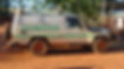
the local police pulled over in their patrol van I'm in trouble -Traveldriven Bidyadanga Otherwise known as La Grange, in the Kimberley region, is the largest Aboriginal community in Western Australia. A population of about 750 residents. One hundred and eighty kilometres (110 mi) south of Broome and 1,590 kilometres (990 mi) from Perth. The traditional owners of the land are the Karajarri people. Entry to Bidyadanga is restricted. Permit may be required. I was offered an opportunity to accompany a two man maintenance work group to a local government building in Bidyadanga for a day on a weekend. Sure, ok. On arrival I wandered about part of the townscape. Always mindful not taking photographs showing locals. This is a sensitive issue in restricted communities. I was careful only to photograph streetscapes and signs with a small camera. Questioned by Local Police of Western Australia However, shortly before all maintenance work was completed the local police pulled over in their patrol van and one of the two officers leaned out of a window and inquired if anyone of us knew of someone photographing the community. The camera bag was slung over my back. We all said no. A white lie on my behalf. No doubt referring to my earlier walkabout. I had not photographed any people at all. Nor pointed the camera at people. Just streets and signs. A misunderstanding avoided. With hindsight I shouldn't have walked around as much drawing attention. Point taken. Fatal stabbings have occurred in this sometimes troubled small community in a tropical environment where life should be carefree. There is little opportunity for youth. Violence amongst locals getting out of hand. Perhaps the result of isolation and boredom with little purpose for some. Traveldriven ENTER CLICK/TAP BIDYADANGA GOOGLE MAPS TRAVEL DOWN UNDER BIDYADANGA BIDYADANGA COMMUNITY COMMUNITY SERVICES SIGN BIDYADANGA STREETSCAPE HIGH FENCES & BARBED WIRE TIDY TOWNS 2014? NO FUN! PAINTED HANDS CAGED FUEL BOWSER CAGED STREET LIGHTS CAMPFIRE ASHES IN TOWN LOCAL HOUSING NO GO AREA, WHY? BIDYADANGA PUBLIC BUILDING BIDYADANGA CHURCH SERVICES SUPERMARKET NOTICE BOARD STORE OFFICIALY OPENED 1984 ANOTHER SUPERMARKET NOTICE BOARD RANGER VEHICLE BIDYADANGA GENERAL STORE PREV SA/WA/NT NEXT HOMEPAGE
- BROOME GINGER BEER BREWERY Day 13 WESTERN AUSTRALIA
tales of the week's activities that quite often ended with a quiet night time beverage at sea -MV Oceanic shipmates DAY 13 Sunday Broome Broome has tide waters that encroach on both sides of the town. The waters of Roebuck Bay extend from the main jetty at Port Drive to Sandy Point and Broome Town Beach shoreline. These and other areas provide views over the mud flats of the famous ' Staircase to the Moon '. Once a month, during this event, a clear night sky, a receding tide, and a rising full moon come together to create the illusion of a staircase to the moon above the mud flats. Matso's Brewery The Brewery was an ideal location to meet up with MV Oceanic shipmates after the Kimberley Islands voyage. Sitting around outside dining tables an onshore sea breeze sprung up and yarns were told between new friends over cold drinks. Highly recommend trying Matso's ginger beer varieties. Yarns of getting your sea legs, being stuck in mud up to the knees, scrambling over rock outcrops, beach sleeping, swimming, retelling tales of the week's activities that quite often ended with a quiet night time beverage at sea. Most experienced none, or very little sea sickness on the entire voyage. All were returning home in the next day or two. Many flying interstate. I was staying in Broome a little longer, then driving to Wyndham, the very tip of Western Australia. Shipmates and Retelling of Shipboard Life All shipmates agreed the seven days roaming the sea in the Kimberley Islands was a once in a lifetime opportunity and exceeded expectations. No complaints with crew or expeditions. Notwithstanding a few things. The captain of the MV Oceanic said the fore deck spa could not be used at all. Also, onboard stowed sails were never used on either of the two masts. Few fish were caught. Sometimes the tender craft were hard to restart on a quickly receding tide. No cell phone reception. Passengers were encouraged to help with meal clean up and use water sparingly. These things did not distract from the experience at all. A great time enjoyed by all. ICON'S OF BROOME WESTERN AUSTRALIA Sun Pictures opened on 9 December 1916. The cinema underwent very regular tidal flooding. Some claimed you could catch a fish watching a movie. In 1974, a levy was built to stop flooding. Currently claimed as the world's oldest open-air cinema in operation. Restored with the help of the unofficial, 'Lord of Broome'. Robert Alistair McAlpine. Streeter's Jetty was built for pearl dealer operations out of Short Street, in1886. A channel was cut through mangroves to Dampier Creek and provided access to Streeter's Jetty for pearl luggers. Streeter's Jetty is 69m in length and was rebuilt in 2022 for the fifth time because of water damage with high tides. Traveldriven TRAVEL DOWN UNDER ENTER CLICK/TAP MATSO'S BROOME BREWERY GOOGLE MAPS IN REALTIME GINGER BEER ALCOHOL SHIPMATES AT MATSO'S GINGER BEER SELECTION MATSO'S BROOME BREWERY. Australia's most remote brewery. Alcoholic ginger beer. BROOME Two weeks in Broome including cruising the Kimberley IsIands. CITY OF BROOME SUN PICTURES BROOME INSIDE SUN PICTURES BROOME SUN PICTURES OUTDOOR THEATRE BROOME CHINA TOWN FAMOUS STREETER'S JETTY OFF SHORT STREET BROOME FAMOUS STREETERS JETTY ENDPOINT OF BOARDWALK MANGROVES FLOOD WITH AN INCOMING TIDE BROOME HISTORY PEARL DIVER PREV SA/WA/NT NEXT