YOUR NEXT TRAVEL EXPERIENCE
Search Results
274 results found with an empty search
- DRIVING TO QUEENSLAND ROAD TRIP AUSTRALIA
ROAD TRIP TOWNSVILLE AUSTRALIA DAY ONE Solo road trip to Queensland via New South Wales from Victoria. Driving a Mustang GT 2017 6 speed manual. Glenrowan Take a rest break and refill your car in Glenrowan. This is a popular rest spot for those travelling on the Hume Freeway 235 km from Melbourne. In the township of Glenrowan, off the highway, tourists can rest and look at the famous Ned Kelly siege sites. Eat a tasty Glenrowan Bakery pie. Read Glenrowan blog post Drive Glenrowan Victoria to Albury NSW 90 km. Overnight stay in Albury. Albury to Gundagai NSW 180 km. Stop by The Dog on the Tuckerbox . Approximately eight kilometres from Gundagai. An Australian historical monument and tourist attraction. Located on the Hume Freeway. There are truck/car food and fuel service centres. Also, home to the Big Koala statue. Not to be confused with the Big Koala on the Western Highway in Victoria. THE DOG ON THE TUCKER BOX GOOGLE MAPS Drive 250 km to Parkes home of 'The Dish' Parkes Observatory. There is a visitors' centre and gift shop. Parkes hosts the annual Elvis Festival in January. Elvis is in the building. Look-a-likes all around town. Rockin' n' rollin. PARKES OBSERVATORY GOOGLE MAPS Drive 155 km from Parkes to Bathurst . Home of the famous Mount Panorama motor racing circuit. Drive over the following days to GOONDIWINDI a rural town in Queensland, Australia. On the border of Queensland and New South Wales. 360 km west of Brisbane. Goondiwindi Road Trip Australia The town has a population of over six thousand people. Home of the famous racehorse "The Goondiwindi Grey" Gunsynd. The horse won the 1971 Epsom Handicap and the 1972 Cox Plate. Placed third in the 1972 Melbourne Cup. GOONDIWINDI GOOGLE MAPS Goondiwindi to Rockhampton . 800 km. Very small towns are along the Leichhardt Highway. Mostly trucks. Very few service stations sell 98 octane petrol. Visit Mount Archer. Six hundred metres above sea level. Eight km from Rockhampton and offers excellent views. It has a short walkway leading to Nurim Circuit elevated board walk viewing platform. Views are of Rockhampton and Fitzroy River. Rockhampton Road Trip Australia Rockhampton is an inland city. Often indigenous teenagers jump off the Fitzroy Bridge into the river to cool off. Although few in number, saltwater crocodiles do inhabit the Fitzroy River. The Koorana Crocodile Farm is interesting. Located in Rockhampton. I held a baby crocodile and tasted a crocodile steak. Better to eat a croc than the other way around. The city seems to get higher day temperature's than surrounding area's likely because it's inland from the coast. Koorana Crocodile Far m Website The tropical coastal town of Yeppoon Qld is 25 minutes drive further on from Rockhampton. Traveldriven CURRENT PARKES FIVE DAY FORECAST ROCKHAMPTON GOOGLE MAPS MOUNT ARCHER NURIM CIRCUIT ELEVATED BOARDWALK CURRENT ROCKHAMPTON FIVE DAY FORECAST ROAD TRIP AUSTRALIA NED KELLY GLENROWAN BIG EARS PARKES NSW GOODIWINDI ON THE BORDER WITH NSW "The Goondiwindi Grey" Gunsynd. ROCKHAMPTON CROCODILE FARM SMALLER CROC MOUNT ARCHER & FITZROY RIVER ROCKHAMPTON YEPPOON WATER PARK QLD PREV ROADTRIP TOWNSVILLE NEXT PREV QUEENSLAND NEXT HOMEPAGE POST
- FLINDERS RANGES, SOUTH AUSTRALIA END OF ROAD TRIP
PARACHILNA Driving past the small settlement of Leigh Creek, a former coal mining town, one approaches Parachilna. Parachilna is sixty-five km south of Leigh Creek and is within a few hundred metres of the roadside turnoff from the sealed, 'The Outback Highway'. Parachilna consists just basically of the well-known Prairie Hotel. Celebrities have been known to frequent the hotel due to feature films made in the general area. Well-heeled patrons come from the cities to experience the outback atmosphere. Fine accommodation and dining is available, and there is an onsite microbrewery with beer on tap. HAWKER Hawker has a population of a few hundred. A very small town in the northern Flinders Ranges between Parachilna and Quorn along 'The Outback Highway' ninety km south from Parachilna. KANYAKA RUINS The ruins located approximately 30 km south of Hawker are a fascinating historical site that offers visitors a glimpse into the past. Accessible by both 4wd and 2wd vehicles, a short turn off The Outback Highway leads to these extensive ruins, making it a convenient stop for travellers exploring the area. The backdrop of brown hills surrounding the site not only enhances its visual appeal but also adds to the sense of mystery and intrigue that shrouds the ancient structures. As you wander through the ruins, you can't help but imagine what life was like for the people who once inhabited this place. This popular wayside stop serves as a reminder of the rich cultural heritage that exists in the Australian Outback, inviting visitors to immerse themselves in the stories of the past and appreciate the enduring legacy of this unique region. QUORN IN THE FLINDERS RANGES Quorn is a Flinders Ranges town. On the edge of the Outback. The first reasonable-sized town south of Birdsville, which is in Queensland 850 km north of Quorn. Quorn has all expected services found in regional towns. The Pichi Richi steam engine and several passenger carriages often leave the Quorn Train Station for an experience of a bygone era. The steam train departs Quorn Train Station on most days for Port Augusta and this is about a 32 km return trip. The train meets and joins the Afghan Express from Woolshed Flat. Quorn is 335 km distant from Adelaide. Laura and C J Dennis C J Dennis the poet spent his formative years in Laura. Born in the year of 1878 in the small town of Auburn, South Australia. He passed away in 1938 and is buried in Melbourne. In the small South Australian town of Laura's main street stands a monument dedicated to the renowned Australian poet. A literary figure whose influence on Australian culture transcends generations. C J Dennis played a pivotal role in shaping the Australian vernacular by popularising the unique slang that has become synonymous with the country's identity. His works not only captured the essence of the Australian larrikin spirit but also celebrated the resilience and humour of the everyday person. Fondly referred to as 'the laureate of the larrikin.' C J Dennis's poetry resonated with audiences far and wide, earning him a lasting place in the hearts of Australians. The monument in Laura serves as a tribute to his enduring legacy, reminding visitors of the profound impact he had on the literary landscape of Australia and the preservation of its rich cultural heritage. Laura to Adelaide is about 230 km via Clare in the Barossa Valley wine region. DESERT SKY TOURS This Desert Sky Tour finished in Adelaide, ending nine days and approximately 3,500 km of driving a 2016 Toyota Land Cruiser through the Outback. There were no incidents or problems. Howard, the tour operator and driver, was a very informative and friendly guide. All agreed that the tour was one of those once-in-a-lifetime road trips. BIRDSVILLE TOURS & THE OUTBACK Of course, Desert Sky Tours are not the only Outback small group tour operators. Other operators may be found with small group tours departing from Adelaide or Brisbane. Many use 4WDs or a high clearance bus. A few operate out of Victoria and New South Wales as well. All reputable tour operators should be found with an affiliation with an established tourist body. There is no need to own a 4WD vehicle, have driving experience, or Outback knowledge to undertake such a road trip. Meals, fuel, accommodation with a proper bed, and a toilet and shower are all included in the reasonable tour price. The providers do this for the traveller. This is great peace of mind in remote areas. Those with mobility issues, travelling alone or as a couple, would find this mode of travel ideal. Towing a large cumbersome van, camping in small tents or swags and a bush toilet doesn't have to be how an Outback road trip is done. Visitors to Australia could easily do such a holiday. Two weeks is plenty of time to allow for flights, etc. Certainly for a nine day Outback adventure. As an Australian, Traveldriven enjoyed the history and the quirky character of the Outback, as did others. People such as Jan, being a solo traveller of the world and of Australia. Thanks to Howard of Desert Sky Tours of Adelaide for his enthusiasm for the Outback, allowing a very few, the opportunity to experience the real Outback. An opportunity made available in safety and comfort. Such a road trip is possible to those many Australians who never venture too far away from the coastal cities. Traveldriven DRIVE MARREE, PARACHILNA HAWKER, QUORN, LAURA PARACHILNA DISUSED TRAIN STATION OPPOSITE PRAIRIE HOTEL PRAIRIE HOTEL PRAIRIE HOTEL EXTERIOR PRAIRIE HOTEL BREWERY NORTHERN, FLINDERS RANGES HAWKER TOWNSHIP SIGNAGE KANYAKA RUINS KANYAKA TOWNSHIP RUINS QUORN TRAIN STATION QUORN STEAM TRAIN LEAVING QUORN STATION QUORN STEAM TRAIN QUORN SHOPFRONT SIGNAGE STATUE OF C.J. DENNIS A LONGTIME RESIDENT OF THE SMALL TOWN OF LAURA PREV PAGE NEXT
- FIERCE STONE WARRIORS & WATERFALLS CRUISE KIMBERLEY ISLANDS
DAY 16 beware of the fierce Stone Warriors -fellow shipmate Many Kimberley Islands have waterfalls. Our tendercraft were piloted up a rock weathered murky green coloured creek followed by a short hike to Ruby Falls . A water dip is said to be safe in the higher shallow rock pools. Crocodiles are rarely seen on many of the islands preferring mangroves. The higher rock pools are considered safe swimming in the latter half of the dry season. It's best to avoid larger low pools and their darker water such as the base of Ruby Falls. Stone Warriors, Cruise Kimberley Islands An excursion highlight was to the Stone Warriors on an uninhabited island. Named Langgi Inlet. Remote and rarely visited. Hundreds of weathered rock outcrops appearing to the imagination as human faces and shapes. Even as animals. The Stone Warriors are best seen on the low tide. Ancient Stone Warriors overlooking this remote island shoreline in the Kimberley heat and sea breeze. White beach sand disturbed only by our footprints in this pristine environment. The Stone Warriors weren't a safety concern. Unless you fall off of one to get a better view. Perhaps with hindsight not the best idea for a better view. No medical aid is available in these remote islands. A lengthy drawn-out helicopter evacuation the only option for serious accidents. We were cruising Kimberley Islands both large and small. Exploring by small tender. Tender craft navigated past swirling whirlpools created by the tides. Often multiple whirlpools in more open bodies of water are seen in between small island groups and their creeks. Dangerous waters ready to claim the unwary. Fishing by hand reel was largely unsuccessful. Skipper Steve occasionally anchored ship above coral reefs so as to catch tropical fish. Use of depth and fish finder equipment to a large extent was unfruitful. Perhaps the bait, lures, or time of day were not suitable as few fish were caught. Any caught fish was cooked by Sue the ship's cook. Assisted by Brian. Traveldriven MV Oceanic Ruby Falls Don't go in the water Saltwater crocodile danger UP ANOTHER CREEK VISTING CATAMARAN CREW MEMBER ON TOP RIGHT ASSISTING A SHIPMATE RUBY FALLS SCENIC AREA SALTWATER CROC HABITAT UNSAFE WALKING THE TOP OF RUBY FALLS SMALL COOL ROCK POOLS TOP OF RUBY FALLS TENDERCRAFT IN CREEK HIKE TO AND FROM RUBY FALLS MARKERS & ODDMENTS RUBY FALLS TRAIL KIMBERLEY ISLANDS STONE WARRIORS FACE OF THE STONE WARRIORS STONE FACE CREW MEMBER GAINING A BETTER VIEW MV OCEANIC VIEW UNDER THE GAZE OF THE STONE WARRIORS BACK TO THE SHIP BY TENDER RETURN TO THE BOAT FOR DINNER EARLY SUNRISE, SWAGS & FISHING BY HAND REEL PREV KIMBERLEY ISLANDS NEXT
- KIMBERLEY ISLANDS SAND CRABS & CROCS WESTERN AUSTRALIA
Don't get crabs in your thongs. -Shipmates Thongs & Crabs Western Australia Thongs in Australia are open footwear. They offer protection underfoot from hot sand and sharp objects. Over two thousand five hundred islands are off the Kimberley coast of Western Australia. Many are unnamed and a few unexplored. The Kimberley islands stretch along the coast from the Western Australian/Northern Territory border in the east, to the northern most islands and down towards Broome. Beach Wildlife Small and Large Small harmless crustaceans are seen to scurry on unnamed island foreshores. Carrying their back made of hard shell. Crocodiles are rarely seen on the islands. Most islands don't have the mangroves crocodiles prefer. It's still possible to encounter one if unlucky. All shipmates were instructed by crew not to dip limbs into water from tendercraft for this reason. Good advice well taken by all. After all, who doesn't want to cruise the Kimberley Islands as safe as possible. Sharks also inhabit the waters and other dangerous sea life. Traveldriven KIMBERLEY ISLANDS SAND CREATURE BEACH BUG CREATURE SMALLER SALTWATER CROCS HELMSMAN 'THIS CROC COULD REMOVE AN ARM' GENERALLY, NO CROCS IN CROCODILE CREEK BUT WHY RISK IT! SMALL NATURAL WATERFALL CROCODILE CREEK SHIP CREW STANDING SHIPMATES SITTING TOLD NOT TO TRAIL BODY PARTS IN WATER, POSSIBLE CROC DANGER ROPE GUIDE UP AND OVER THE ROCKS IN THE HEAT OF THE DAY GAINING ACCESS TO A SAFE ROCK POOL ABOVE THE CREEK SMALL MINNOW FISH IN CREEK PREV KIMBERLEY ISANDS NEXT
- KIMBERLEY ISLANDS ALL SWAGS ON DECK & HOME PORT WESTERN AUSTRALIA
a female passenger had been left behind on Raft Point leaving the woman stranded on the remote beach - Australian Maritime Safety Authority KIMBERLEY ISLANDS OF AUSTRALIA DAY 20 SUNDAY End of Kimberley Islands Cruise Western Australia Final day at sea and back to home port. All crew and passengers had an incident free, safe and enjoyable time on this Kimberley Island cruise. Crew member Paul was to captain the next cruise of the MV Oceanic. Not unusual for ships to rotate skippers. Captain Steve was helicopter certified with a private licence and Geraldton based. Paul, Wyndham based. During a cruise in late 2017 to the Raft Point indigenous rock art site in Doubtful Bay. A report released by the Australian Maritime Safety Authority noted a female passenger had been left behind on Raft Point. No head count undertaken by crew. Leaving the woman stranded on the remote beach. Before the MV Oceanic set sail a tendercraft was dispatched to retrieve the distressed woman. Attention was also drawn to MV Oceanic previous issues with the seaworthiness, stability, electrical wiring and firefighting equipment. Asserting the vessel owners Ahoy Buccaneers lacked basic safety practices. I and none of the passengers of our cruise had fault with crew on our safety. Crew were disciplined, motivated and helpful. It was reported in the Western Australian ABC Kimberley news media Mv Oceanic sustained damage in April 2018 after running aground on a reef in remote Western Australia leading to the helicopter evacuation of 14 passengers. Mv Oceanic placed into administration and out of service as of 2020. Vessel to be sold. There are no accounts of further sailings up to 2025. A sorry conclusion for all who sailed on the Mv Oceanic. Traveldriven CRUISING THE KIMBERLEY ISLANDS TROPICAL REEF FISH SWAG ON THE BOAT UNDERCOVER MV OCEANIC MY SWAG ON DECK MY SWAG SLEEP ON DECK IN THE TROPICAL NIGHTS OUT OF DATE? SELF SERVE BREAKFAST BREAKFAST DOWN THE HATCH LITERALLY CATCH OF THE DAY STORAGE SHIP CAPTAIN STEVE'S OFFICE AT LEAST THERE ARE NO ICEBERGS IN THE KIMBERLEY lol PREV KIMBERLEY ISLANDS NEXT GO TO ROADTRIP WA/NT/SA RELAXING AT MATSO'S IN BROOME WITH SHIPMATES AFTER THE CRUISE NEXT
- HORIZONTAL FALLS & HAT SNACK KIMBERLEY ISLANDS
DAY 19 Horizontal Falls Locals call them the (Horries) and the falls are described by David Attenborough as a great natural wonder of the world. Located on the coast of the Kimberley region in Western Australia. The falls form when seawater rushes through two short and narrow gorges which are about three hundred metres (1,000 ft) apart. The falls are located in the coastal Mclarty Ranges within Talbot Bay and within the Buccaneer Archipelago. The seaward gap is about twenty metres (70 ft) wide. The landward one is about ten metres wide (30 ft). The natural wonder is caused by the sea level change due to tides of up to ten metres (33 ft). Water builds up on one side or the other of the gaps faster than it can flow through. Creating a wall of water up to four metres (13 ft) high. With the change of the tide, the direction of the falls reverses from inflow to outflow and back again. Cruise Kimberley Islands Captain Steve, dropped ships anchor in Talbot Bay. Tendercraft took those who decided on a helicopter flight to a pontoon floating in the bay. Helicopter doors removed and flown by a barefoot pilot. Best for the heat or a water ditch, I guess. The flight does several passes over the falls and back along the ranges. Quite often, rising air thermals buffer the helicopter on banking. Just the secure seatbelt to hold you in place stopping a fall to the water far below. Flight commentary is via passenger headsets. A few seaplanes bring people out of Broome. These flights were landing and taking off from Talbot Bay. Allowing passengers to disembark and go jet boating through the narrow gap of Horizontal Falls. Most of my ship mates and myself did the jet boat experience as an excursion extra. It is too dangerous for anything other than multi-engine jet boats to pass through the Horizontal Falls entrance. It can be likened to a high-speed thrill similar to jet boating in river canyons. But on steroids. All can expect a wet ride. Our ship MV Oceanic safely anchored alone in Talbot Bay for the night surrounded by rugged mountain ranges. There is no land access to Horizontal Falls by road or track. Seaplane or ship only. There are calls for a complete ban on travel to Horizontal Falls by the traditional landowners for the reason given below and cultural obligations. Access through the narrowest gap by tourist jet boat are discontinued as of 2023. Talks are ongoing between Dambeemangarddee Aboriginal Corporation and the Western Australian state government. Traveldriven Tuesday, May 30, 2023, Media Release Charges were laid last Friday 26 May 2023, against the master and company that owns the high-speed vessel Falls Express , which collided with rocks at Horizontal Falls on 27 May 2022 while carrying 25 passengers and 2 crew on an eco-tour of Talbot Bay in Western Australia. Dozens of people onboard Falls Express were seriously injured as a result of the domestic commercial vessel’s operation at high-speed through the narrow 7.5m gap at Horizontal Falls. The response effort, by emergency services and other domestic commercial vessels operating in the area at the time, was rapid and commendable. The Australian Maritime Safety Authority (AMSA) has meticulously investigated the incident, gathering, and analysing evidence over the past year. With support from the Commonwealth Director of Public Prosecutions, charges have now been laid under the Marine Safety (Domestic Commercial Vessel) National Law Act 2012 (the “National Law”). The master, Edward James Whisson, has been charged with two safety-related offences— failing to take reasonable care, and not implementing and complying with the safety management system for the vessel and its operations. The owner, Journey Beyond Adventures Pty Ltd (trading as Horizontal Falls Seaplane Adventures), has been charged with two offences for failing to, so far as reasonably practicable, ensure the safety of the vessel, its equipment and the operation of the vessel; and failing to implement and maintain a safety management system that could ensure Falls Express, and its operations, were safe. As this matter will now proceed to the Magistrates Court of Western Australia, it would be inappropriate for AMSA to comment further. Australian Maritime Safety Authority CLICK/TAP TO ENTER HORIZONTAL FALLS GOOGLE MAPS ISLAND CAMPFIRE ON A HOT KIMBERLEY DAY MV OCEANIC & BROOME SEAPLANE HORIZONTAL FALLS BY HELICOPTER HORIZONTAL FALLS THROUGH THE GAP HORIZONTAL FALLS BY DAVID ATTENBOROUGH HORIZONTAL FALLS BY SEAPLANE HORIZONTAL FALLS JET BOAT CRASH 2022 A REST BETWEEN EXPEDITIONS CREW GETTING THE CRAFT READY TO EXPLORE HIGH TIDE MARK ISLAND SNACK OR DRYING WET HAT? NEST HIGH ON ROCKS EAGLE'S NEST GOING UP RIVER CROC SPOTTING COCKATOO ISLAND UNLOADING IRON ORE TRUCK OUT THE HATCH STEPS TO THE GALLEY INSIDE SHIP WALKWAY THE BOAT ENGINE ACTIVITIES FOR TODAY & SUE THE COOK ROLLED UP SWAGS PREV KIMBERLEY ISLANDS NEXT PREV WESTERN AUSTRALIA NEXT HOMEPAGE
- ONE MILLION KANGAROO'S & SKYLAB NULLARBOR TOWNS?
DAY 3 What it feels like to be nowhere? Then, drive Cocklebiddy to Balladonia 220km. -A no man's land. Outback Driving Although the one and only East\West road between the southern Australian states and Western Australia is fully sealed it's very remote and isolated country. The Eyre Highway skirts the fringe of the Nullarbor Plain and the highway has the longest stretch of straight road in Australia. Perhaps is one of the longest in the world. Needless to say, there is no road side fencing. No roadside train tracks, no power lines, few trees and no signs of civilisation for hours of driving, just the never ending road. NASA FIRST SPACE STATION 'SKYLAB' 1974 Cocklebiddy Western Australia The area is basically a roadhouse. The name of the roadhouse is the Wedgetail Inn and has a caravan park, and hotel motel facilities. Balladonia Beyond the Nullarbor Is a small roadhouse settlement across the border on the Eyre Highway in Western Australia. The Balladonia roadhouse has a display of Skylab debris and newspaper clippings, as well as hotel and motel rooms. In July 1979, the area gained global attention with the re-entry of Skylab. An orbiting NASA space station. A long trail of small debris was scattered across the nearby countryside. Traveldriven SKYLAB RE-ENTRY ON BALLADONIA BALLADONIA WESTERN AUSTRALIA TOURIST BOARD INTERESTING LONG & STRAIGHT DRIVE LONG DRIVE FOR A NULLARBOR STICKER SEDAN DRIVING OUTBACK HIGHWAYS DISPLAY SIGN 1,234,567 KANGAROO'S ONLY OUTNUMBERED BY THE FLIES KANGAROO NUMBER ON SIGN IS WAY TOO LOW lol PREV SA/WA/NT NEXT PREV WESTERN AUSTRALIA NEXT HOMEPAGE
- LOCH NESS & NESSIE PROOF
LOCH NESS CRUISE ON THE LAKE Loch Ness deepest point is two hundred and thirty metres. (126 fathoms; 755 ft). Full day bus tours are available to Loch Ness leaving from Edinburgh. Tours take tourists through the Scottish Highlands and countryside. Views are of roadside highland cattle and farms dotted around the countryside. The tour bus driver with a thick Scottish accent added a unique charm to our journey. Despite the initial challenge of deciphering his words, we soon found ourselves captivated by the melodic cadence of his speech. His accent painted a vivid picture of his homeland, transporting us to the rugged landscapes and historic castles of Scotland with each word he spoke. As we traversed the winding roads and rolling hills, his stories of local folklore and traditions enriched our experience, providing us with a deeper understanding of the rich cultural tapestry of the region. Though there were moments of confusion, we embraced the opportunity to learn more about his heritage and appreciated the authenticity he brought to our tour. In the end, the bus driver's Scottish accent became an integral part of our adventure, leaving us with lasting memories of a truly immersive and unforgettable journey. There is much friendly rivalry between east and west Scottish cities according to the driver. Particularly Edinburgh and Glasgow. On Loch Ness & Nessie The tour boat experience on Loch Ness was truly exceptional, thanks to the highly knowledgeable and engaging guides on board. These guides not only provided valuable information about the history and geography of the area but also delved into the intriguing legend of Nessie, the mythical creature said to inhabit the depths of the loch. Their insights and expertise added a fascinating layer to the tour, sparking discussions and debates among the passengers. One of the most compelling aspects of the tour was the guide's opinion on the legend of Nessie. With a blend of facts, folklore, and personal anecdotes, the guide presented a compelling case that resonated with many on the boat. Their perspective shed new light on the mystery surrounding Nessie, offering a plausible explanation that seemed to strike a chord with those seeking to unravel the truth behind the myth. As the boat glided across the serene waters of Loch Ness, passengers were not only treated to breathtaking views of the Scottish Highlands but also to a deeper understanding of the cultural significance of the legendary creature said to lurk below. The guides' passion for their subject was palpable, and their ability to weave together history, science, and local lore created a truly immersive and enlightening experience for all on board. By the end of the tour, many passengers found themselves pondering the guide's words and reflecting on the age-old mystery of Nessie. Whether a believer or a skeptic, everyone aboard the tour boat on Loch Ness departed with a newfound appreciation for the enduring legend that continues to capture the imagination of people around the world. The only Nessie sighting on the day was the sticker on the window of the boat. Traveldriven CLICK TO ENTER LOCH NESS https://www.google.com/maps /place/Loch+Ness LOCH NESS LAKE CRUISE NESSIE THROUGH THE WINDOW NESSIE SPOTTED ON THE LOCH? PAUSIBLE EXPLANATION OF LOCH NESS MONSTER PREV PAGE NEXT HOMEPAGE POST
- SILVERTON MAD MAX OUTBACK AUSTRALIA ROAD TRIP
Finishing the meal and seeing the Mad Max vehicles drive past, I also needed to hurry on to Mundi Mundi Lookout behind them before sunset. - Traveldriven Silverton, Mad Max in Outback Australia The town has a population of about fifty. Located in the far west of New South Wales in Outback Australia. Twenty-six kilometres north-west of Broken Hill along a sealed road. Surrounding Silverton are the locations of Mad Max 2 movie sites. Accommodation is available within the Silverton Hotel. Rear of the hotel there are units for guests. There are also Penrose Park edge of town camp sites. Lamb Meat Pie and onto Mundi Mundi Lookout Eating a tasty lamb pie from the Silverton bakery for lunch a Mad Max interceptor arrived out the front. A local Broken Hill police patrol car had just left the bakery. Good timing. During dinner, seated at a table and chairs outside the swinging doors of the Silverton Hotel, I enjoyed a hamburger and a cold light beer. All of a sudden, I noticed vehicles and motorbikes with a Mad Max theme from Wasteland driving past the hotel at the very end of the street, on their way to Mundi Mundi Lookout for a sunset gathering. For a brief moment I thought of Goose the MFP motorbike rider from the original Mad Max film. Eating his meal at a roadside diner with a chase going past. Goose jumped on his bike and joined the chase. Finishing the meal and seeing the Mad Max vehicles drive past, I also needed to hurry on to Mundi Mundi Lookout behind them before sunset. Traveldriven SILVERTON GOOGLE MAPS SILVERTOWN Mad Max and driving the interceptor Parking in front of the Silvertown Bakery. Apparently, the driver of the interceptor drove from Cobar NSW to Outback Silvertown a distance of about 460 km for the Mad Max 2 40th anniversary gathering. 'Kick it in the guts Barry' supercharger. Mad Max movie scene, bridge incident Mad Max Ford Falcon MAD MAX 1 SCENE GOOSE JOINS THE CHASE AT DINER EAT A MEAL OUT THE FRONT HAMBURGER WITH THE LOT $22 Eating a hamburger and Mad Max vehicles driving past to Mundi Mundi Lookout THE INTERCEPTOR LOVE CHILD BROKEN HILL PROPRIETARY COMPANY SILVERTON 'ORIGINAL OUTBACK' HOTEL BACKYARD ABANDONED HOUSE AND SCOOTER OFF THE MAIN STREET, SILVERTON SHOP FRONT 1987 MUSTANG & MAD MAX MUSEUM SILVERTON PARKED IN THE MAIN STREET ART STORE & ARTIST WORK SHED SILVERTON JAIL CELL HOMETOWN OF MAD MAX? SILVERTON & SILVER CITY HIGHWAY 2007 PREV NSW NEXT HOMEPAGE POST
- LAND OF THE KIWI, QUEENSTOWN
QUEENSTOWN A resort town, or rather a regional city, in Otago in the south-west of New Zealand's South Island. Resident population of about sixteen thousand. Tourists swell this number by the thousands. Queenstown is built around an inlet called Queenstown Bay on Lake Wakatipu, a long, thin, Z-shaped lake. Spectacular views are of nearby mountains such as The Remarkables, Cecil Peak and Walter Peak. All are often snowcapped and the area is well known for its snow skiing. Glenorchy Is a small settlement at the northern end of Lake Wakatipu in the South Island region of Otago, New Zealand. It is forty-five km (28 mi) by road or about the same by boat from Queenstown. There are two pubs, a café and a number of small shops in the town catering mainly to tourists but also to the small-town population. Driving in Queenstown is fairly easy. Some streets are narrow and one way. Many tourist activities are in the town and surrounds. On Lake Wakatipu foreshore there is a larger than life statue of a Kiwi bird. This flightless bird is only found in New Zealand and is a nickname for all people born in New Zealand. Almost becoming endangered from predatory introduced animals, they now number about seventy thousand and individuals can live longer than twenty years. They are a nocturnal bird and are found in ground burrows. The Kiwi's claws are sharp and dangerous. Glenorchy is mainly on flat terrain tucked up to extensive mountainous, snowcapped areas and Lake Wakatipu. To visit Glenorchy the only option is to drive and return back to Queenstown on the same road. The entire Queenstown - Glenorchy road is driven next to scenic Lake Wakatipu with views to The Remarkables range across the water. The views are quite remarkable. Pun intended. The often snowcapped remarkable, " The Remarkables " mountain range runs the length of Lake Wakatipu. Queenstown to Glenorchy road is a well maintained very scenic sealed road hugging the foreshore. Generally, vehicle snow chains are not required. I know of two other Glenorchy namesakes. One in Victoria and one in Tasmania and have been to all three. Lake cruises depart Queenstown daily and cross Lake Wakatipu to Walter Peak High Country Farm aboard the historic steamship TSS Earnslaw. It's very relaxing gliding along the water with spectacular mountain views. Sometimes goats are seen grazing on the steep slopes beneath the Queenstown Chairlift. Lake Tekapo is just short of 300 km from Queenstown and on the road to Mount Cook National Park. During winter and spring months the Southern Lights or 'Aurora Australis' may sometimes be seen in the night sky. Traveldriven QUEENSTOWN GOOGLE MAPS GLENORCHY GOOGLE MAPS LAKE TEKAPO GOOGLE MAPS Queenstown Chairlift Queenstown the most remarkable Remarkables Range Giant Kiwi Queenstown SHOTOVER JET BOAT ON THE SHOTOVER RIVER Hit the road in a hire car Queenstown to Glenorchy Road On the road to Glenorchy WELCOME TO PARADISE Lake Wakatipu and the 45 km drive to Glenorchy GLENORCHY TIME The Church of the Good Shepherd, Lake Tekapo Lake Tekapo PREV PAGE NEXT HOMEPAGE
- ARROWTOWN THE OLDE & QUAINT
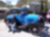
Arrowtown is a small historic gold mining town in the Otago region of the South Island of New Zealand. The town is on the banks of the Arrow River about seven km from State Highway 6. There is road access directly to Queenstown via the Shotover Gorge. Also, via Lake Hayes. Arrowtown is an easy twenty minute drive from Queenstown. Whilst in Arrowtown a vintage car display was on show. Anything from days gone by. Themed attire. Cars and other vehicles. Market stalls and a brass band played tunes. Ideal weather. Very laid-back atmosphere compared to the hustle and bustle of nearby Queenstown. A very good contrast. Everyone enjoying the outdoor entertainment. Traveldriven ENTER CLICK/TAP ARROWTOWN GOOGLE MAPS OLD TIMER? NEW ZEALAND CRACKS PEOPLE UP LAND OF THE BIG SHEEP DOG ARROWTOWN VINTAGE CARS VINTAGE PUSH BIKE VINTAGE DRESS TWO OLD TIMERS VINTAGE DRIVE LAND OF THE RABBITS? PREV PAGE NEXT HOMEPAGE POST
- UFO ENCOUNTER & ALIENS Day 37 NORTHERN TERRITORY
WYCLIFFE WELL of the NORTHERN TERRITORY The area has a claim to be the UFO centre of Australia. Wycliffe Well used to be a welcome service stop for highway traffic but now as of 2025 has fallen into ruin. Services and fuel are no longer available. The general area is deserted and trashed by vandalism. The photos below are of before the closure of the roadhouse and fuel service station. Wycliffe Well’s UFOs sightings started during World War II when servicemen living in Wycliffe Well started keeping records of nightly observed unidentified objects. Despite being observed on many occasions these objects were never satisfactorily explained. Lights are still seen to this day. Very remote and isolated area. Desert country. Roaming roadside wildlife or even livestock are more of a concern than UFO encounters. No livestock is fenced and there is always the chance of native wildlife such as kangaroo bolting across the highway where there is very little in the way of vehicle repair in these remote areas of the Northern Territory of Australia. Traveldriven DRIVE DEVILS MARBLES - WYCLIFFE WELL - AILERON - ONTO ALICE SPRINGS A NEW FRIEND IN WYCLIFFE WELL OUTBACK UFO's? AILERON MAN AILERON WOMAN OUTBACK ROADHOUSES ALIENS IN AN ALIEN LAND OUT OF THIS WORLD UFO'S IN THE OUTBACK WYCLFFE WELL, ALIENS INSIDE UFO NEWSPAPER CLIPPINGS ALIENS IN THE SKY, NOW ON THE ROOF TROPIC OF CAPRICORN TROPIC OF CAPRICORN MARKER OUTBACK WILDLIFE IS SCARIER THAN ALIENS PREV SA/WA/NT NEXT HOMEPAGE